
Tracing a San Bernardino County Street
A San Bernardino County street directory search works best as a short chain. The Public Assessor Map translates a house number into a parcel. The parcel record supplies an APN, current or inactive owner fields, document numbers, and a legal description. GIS then supplies the surrounding map, municipality, community, point type, and ZIP. The Recorder accepts the resulting names and dates, not the street itself. Historical occupants come from the California Room's address-first criss-cross collection, newspapers, census schedules, or other local sources.
Walk in this order so each step has a clear purpose:
- Enter the exact situs address in govPIMS. Save the APN, owner name, acquisition date, document date, and legal description shown in the parcel result.
- Open the parcel map and pan along both sides of the street. Select nearby polygons one at a time; the county does not document a public all-residents street export.
- Use the site-address GIS layer to confirm the municipality, community, point type, and five-digit ZIP attached to each address point.
- Search the current owner as a grantee in the Recorder index, then match the document number or legal description before stepping to the grantor.
- Use permits for construction chronology and the criss-cross directory for a historical person-at-address clue. Treat both as evidence with a date, not as a complete list of household members.
Note: The address is the first key, but the APN and legal description keep a street search tied to the right parcel when names or numbers change.
San Bernardino County Assessor Fields by Address
The San Bernardino County Assessor Property Information portal calls its address mode a Situs Address Search Utility. It also offers Parcel Search, Name Search, and Parcel Utilities. The public report reaches beyond a simple owner card. It may show parcel status and type, use code, responsible group or unit, district, tax status, land type, access, size, current-owner name, relationship, interest percentage, owner type, acquisition date, document date, and document numbers. Tabs include Property Info, Roll Values History, Parcel History, Owner History, Supplement History, Land, SFR, and Other Chars.
The search controls matter because they decide whether a prior name appears. Active Names is checked by default and Inactive Names is unchecked. Formatted Name searches structured fields, while Unformatted Name searches the literal form. The parser breaks the address into street number, street name only, city, state, and ZIP. A mailing address can be absent or protected under Government Code §§7928.200-7928.205. No field should be described as proof of every person at the site.
The visible address and owner controls are:
| Field or control | Type | Required/default | What it does |
|---|---|---|---|
| Parcel Number | Text | Required in parcel mode | Opens a parcel directly |
| Address | Text/autocomplete | Required in address mode | Street number, name, and city search |
| First Name / Last Name | Two text fields | Marked required in name mode | Searches owner names |
| Active Names / Inactive Names | Checkboxes | Active checked; inactive unchecked | Includes current or older names |
| Formatted / Unformatted Name | Checkboxes | Formatted checked; unformatted unchecked | Uses structured or literal matching |
| Generate Attached Parcel Report | Button and utility value | Required for report output | Returns parcel, owner, history, and value fields |
Annual roll summaries reach 1978-present, while the interactive map is the practical first stop for a current street. Assessor Services at 909-387-8307 is the phone fallback for an APN or assessment question. The assessor does not adjudicate legal title, and an owner field is not the same as an occupant field.
The ARC property-information hub is the source for the map and current search route.
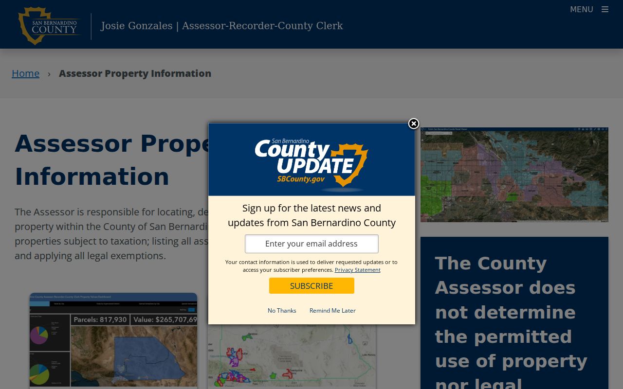
The parcel interface gives the San Bernardino County street directory its address-to-APN starting point.
San Bernardino County GIS Street Browse
GIS adds the geography that a parcel report cannot show by itself. The county's site-address service exposes an address point, municipality, community, point type, and five-digit ZIP. The public GIS service directory is linked through the county's map portfolio and ArcGIS services. Search one address, select its parcel, keep the block visible, and click adjacent or facing parcels one by one. That is a map-browse method, not a radius search that returns a resident roster.
Parcel History can show splits and combinations. A present lot may not match the shape or number used in an older directory. Parcel book and page provide map-sheet context, while a legal description connects the modern parcel to a recorded instrument. GIS is strongest for place, adjacency, and jurisdiction. It does not identify utility customers or every person who uses a building.
The county site-address GIS layers show the geographic fields used to check an address.
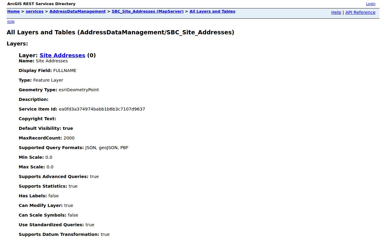
The layer ties a point to a ZIP and local geography, but the absence of a name field is an important part of what the map tells you.
San Bernardino County Street Record Sets
A complete street directory workflow uses several custodians. Each record set has an index key and an access channel. The table below keeps the current address trail separate from the historical household trail.
| Record set | Keeper | Street-level clue | Access |
|---|---|---|---|
| Property and tax roll | ARC Assessor | Situs, APN, owners and history, values, exemptions | Free Public Assessor Map; phone 909-387-8307 |
| Site-address GIS | County GIS | Address point, municipality, community, ZIP, point type | Public ArcGIS services |
| Parcel maps | Assessor and GIS | Lot shape, map book and page, tract context | Public parcel-map viewer |
| Deeds and liens | ARC Recorder | Transfers and indexed party roles after a name bridge | Free index; office viewing or paid copies |
| Permits | LUS or the relevant city | Work chronology and applicant or owner evidence | EZOP, counter, or city system |
| Criss-cross directory | California Room | Historical person or household by street and number | In-room collection and paid research |
| Voter file | County Registrar of Voters | Registered-voter residence for a permitted purpose | Application, wet signature, and statutory review |
| Census schedules | Federal records and library | Historic occupants and relationships | Public through 1950 under the 72-year rule in 2026 |
The parcel number is the handoff between the assessor, map, permit, and recorder portions of the San Bernardino County street directory. The street name alone is weaker because postal names, municipal boundaries, and older address conventions can vary. A current owner field can lead to a deed; it cannot turn the whole street into a public household list.
San Bernardino County Addresses Have Three Meanings
Three location terms recur in every address search. A situs address is the physical place used by the assessor's address utility. A mailing address is where tax or other correspondence may go and can be off-site or suppressed. A legal description identifies the land in a deed, often by tract and lot in an urban area or section-township-range in a rural area. A plat is a recorded map that helps explain lots, blocks, and boundaries. Those terms are related, but they are not interchangeable.
- Parcel
- A tax and mapping unit identified by an APN. It can change when lots split or combine.
- Situs address
- The physical address attached to a place. It is not automatically the tax-mailing address.
- Plat
- A recorded or assessor map that supplies lot and block context for a legal description.
- Criss-cross directory
- An address-first directory that reverses the usual name-first arrangement and can show a historical person at a house number.
San Bernardino County APNs have 13 characters, arranged as book, page, line, parcel type, and suffix or sequence. Parcel-map search accepts a book-and-page form such as 016723 or an index-map form such as 0113i1. These formats help navigate maps. They do not replace the legal description in a recorded document or establish who occupies a parcel.
Permits Date San Bernardino County Buildings
A deed usually conveys land. It may say little about when a structure was built or altered. Land Use Services building and safety records are therefore a separate address trail. The county's permit research guide says county permits generally begin around 1936, while incorporated cities may hold earlier or different series. Search the unincorporated county route through EZOP, ask at the relevant counter, and contact a city when the address falls inside a municipal permit system.
Permits can supply construction dates, work descriptions, and applicant or owner evidence. The first appearance of an improvement in an assessor lot book can also help date a structure, although the lot book may not say whether the improvement was a house, barn, or shed. Pair a permit or improvement entry with a deed and directory year instead of forcing one source to answer every question.
The county EZOP permit portal is the online access point documented for county building research.
A permit record adds a work date and project context to the address chain.
The Land Use Services permit guide explains why city and unincorporated records may split.
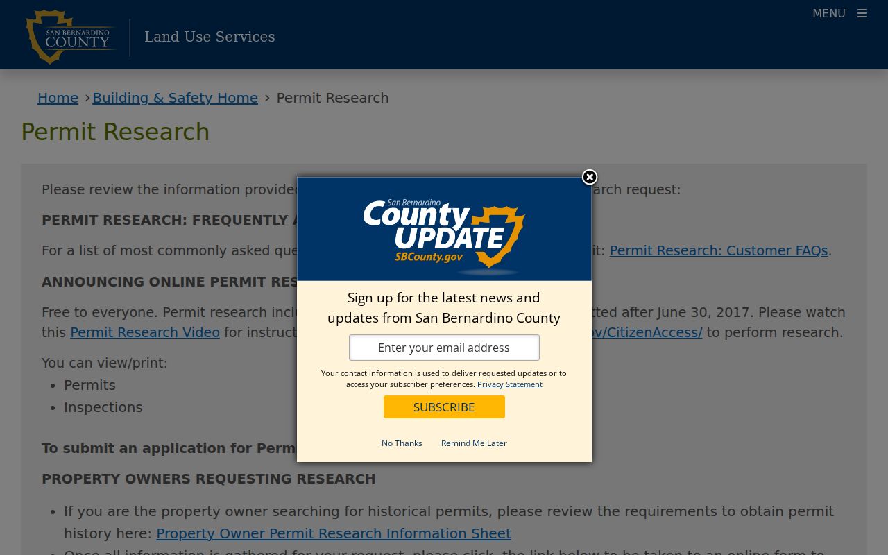
The building-safety route is a useful fallback when a property search needs construction history rather than another owner name.
San Bernardino County Deed Chains Along Streets
The Recorder's index is name-first. Start with the current owner found in govPIMS and search that person as grantee. Compare the candidate documents by date, document number, and legal description. Open or order the acquisition instrument, record its grantor, then search that grantor as grantee. Repeat until the index reaches the practical boundary. A name hit without the same land description is not enough.
The official Recorder page says the index covers 1925-present, while the county property-research guide documents online and office chain research from 1958-present and pre-1958 decade microfilm. Images are not displayed online. Inspect them at the Hall of Records or High Desert Government Center, order copies, or use the mail channel to 222 W. Hospitality Lane, 1st Floor, San Bernardino, CA 92415-0022. Recorder-Clerk Services can be reached at 909-387-8306, and appointments are strongly encouraged.
A recorded party can be a grantor, grantee, lien claimant, trustee, or other role. The deed chain shows transfers and encumbrances. It does not show every person at the address. For older street work, keep a note of spelling variants and compare the legal description before accepting a chain link.
Criss-Cross Directories by San Bernardino County Address
The Arda Haenszel California Room lists criss-cross directories from 1976-present. These volumes reverse the usual name-first pattern, making a house number and street a useful entry point for historical person research. Telephone books run from 1918-present, while San Bernardino city directories are listed from 1887-1968. The published holdings leave a documented 1969-1975 gap unless library staff confirm another source.
Use the address section, note the exact printed name and any spouse or occupation, then compare the entry with a nearby telephone book, census schedule, newspaper notice, or deed. Call 909-998-4251 before a visit because the California Room hours are shorter than the main library. Mail research costs $20 per hour or any part of an hour, plus $0.25 per copied page. The full collection details and sample entries belong on the San Bernardino County directory book page.
The gap is an important search clue, not proof that no directory exists. Try initials, widow entries, alternate street names, and nearby community names before moving to a different custodian.
The county property-research guidance connects historical address work to the modern parcel and deed chain.
Historical property guidance helps keep an old street clue connected to the parcel language used by later records.
Route 66 Names in San Bernardino County
Street names can change while the land stays put. In San Bernardino County, Route 66 appears as Fifth Street in San Bernardino, Main Street in Barstow, 7th Street in Victorville, Foothill Boulevard through Upland, Rancho Cucamonga, Fontana, and Rialto, and National Trails Highway in other stretches. Barstow also has earlier names including Grapevine and Camp Sugarloaf. Test the historic label, a directional prefix, and a community name when a directory does not match a modern map.
Helendale and Silver Lakes offer a related geography problem: USPS and Census use different place names for the same search area. A street directory result can fail because the researcher changed the place name too soon, not because the household or parcel is absent. Early California Room maps can help resolve an obsolete street or lot before the recorder or census search is repeated.
What a San Bernardino County Street Directory Misses
No public street directory captures every household member. A tax owner may live elsewhere. A homeowners exemption is evidence consistent with owner occupancy, not proof of every person there. Non-owner household members, minors, utility customers, and DMV address holders are not supplied by the assessor, GIS, or recorder. Voter records are not a casual street-browse tool, and protected or confidential voters may be omitted. That boundary is part of what the San Bernardino County street directory can responsibly show.
California's DPPA and Vehicle Code §§1808 et seq. restrict DMV information. Government Code §§7928.200-7928.205 can suppress selected assessor fields, while Safe at Home provides substitute-address protection for qualifying participants. The absence of a name should be recorded as an access limit rather than filled with an inference from a different household.
Lawful personal use. San Bernardino County street and address records support family history, parcel research, and ordinary civic curiosity. Do not use them to stalk, harass, intimidate, or harm any person.
San Bernardino County Street Records at the Counter
When the web trail stops, the next channel depends on the record. ARC can help with APN questions by phone and supplies Recorder images through office inspection or copy orders. The Hall of Records and High Desert Government Center are the documented image locations. Land Use Services handles county permit research, while a city may hold an incorporated address's older permits. The California Room handles historical directories and mail research. The county Archives holds lot books, probate, and Great Registers, but its building is currently marked closed, so contact ARC-DLRecArchive@arc.sbcounty.gov or 909-387-1001 first.
The California Public Records Act can request a reasonably described existing agency record. Government Code §7922.535 gives a 10-calendar-day determination period, with up to 14 additional days for specified unusual circumstances. It does not require a new all-street report, and dedicated assessor, recorder, permit, voter, vital, and court services should be used when they already exist. A focused request names the address, APN, document range, and record type.
Note: A street search that reaches a counter, library shelf, microfilm reel, or request form is still a successful route when the online index is narrower.